Sensor Optimization Modeling System
Intelligent sensor placement based on real-world conditions

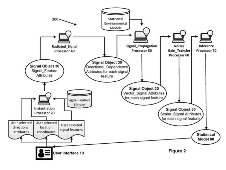
This new system uses physics-based three-dimensional models and real-world inputs to determine optimal sensor selection and placement. Based on variables specific to a situation — such as terrain, noise, weather patterns, and more — it is designed to recommend the most appropriate sensor type, number, and location, and provide probability maps showing where signals from various threats will and will not likely be detected. The system uses detailed environmental data with defined attributes and unique source functions to ensure the reliability of the model.
Users without technical expertise in physics or mathematics can enter inputs such as sensor types (acoustic, visual, radio, infrared, etc.), location coordinates, and sources (on-ground vehicles, aircraft, etc.). The model then pulls relevant information about terrain, weather, ground cover and other location-specific factors to inform mathematical models that identify sensing detection probability. In addition, a user can run the optimal sensor placement tool, which determines the optimal sensor network configuration (the number of sensors, types, and locations) to provide coverage without blind spots.
Sensors provide mission-critical analysis to military and civilian teams, particularly in remote, inhospitable, or complex environments. Yet selecting the most effective type of sensor for a given situation and placing it optimally can be difficult, time-consuming, and risky. Teams must venture into these regions to test different configurations to determine the most effective placement, as signals from sensors can be affected by weather conditions, distance, background noise, and physical barriers such as buildings, mountains, and trees. While prior existing models could predict the outcomes of sensor placement in primarily flat terrains, these models are unable to accurately predict a signal’s path in urban, forested, mountainous, or other complex environments.
Benefits:
- Comprehensive: Models wide range of variables (e.g., terrain, noise, weather)
- Design optimization: Calculates optimal sensor selection and locations
- User-friendly: Can be easily used in the field without technical expertise
Applications:
- Military surveillance
- Mission planning
- Critical infrastructure protection
- Disaster warning systems
- Oil pipeline monitoring
- Air quality monitoring
- Geographical Information Systems (GIS) integration
Patents
- 11675684 (Copy & search patent)
- 10366183 (Copy & search patent)