Real-Time Digital Buoy Tracking and Mapping System
Real-Time, Scalable Tracking

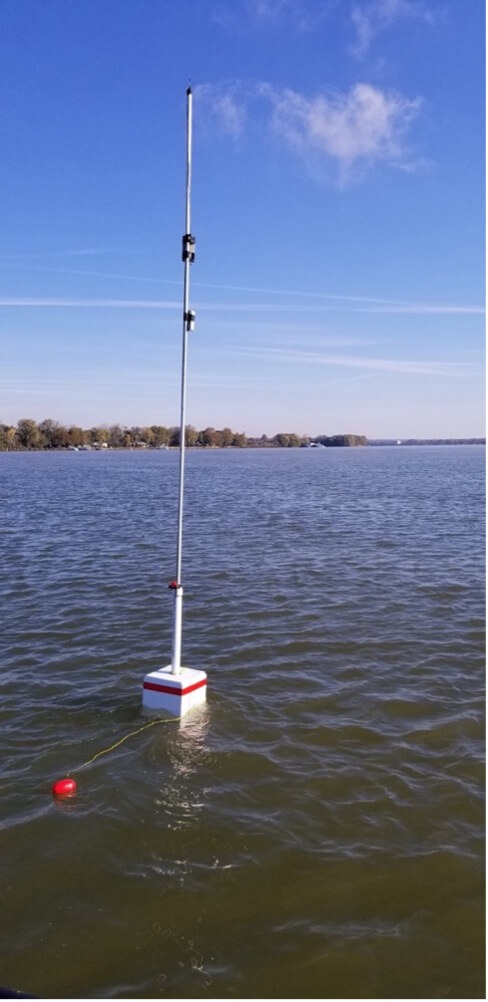
Cost-efficient and low-maintenance digital buoy system provides real-time mapping data. To address this need, the Digital Buoy System enables a distributed network for real-time tracking and monitoring of buoys — even in areas lacking cell-tower coverage. With Digital Buoy, a node is mounted on each physical buoy that records, computes, and reports the buoy’s location and motion data. Each node receives and transmits the data of the neighboring nodes in a peer-to-peer fashion, alleviating the need for costly communication towers. Storing these data in cloud services enables operational and geospatial analyses and for accurate charts/maps of the buoys to be published over the Internet.
This low-cost, low-power, and low-maintenance system is designed to significantly reduce buoy-tendering operational costs and provide enhanced marine navigation to U.S. private and public industries. No other competing technologies offer the scalability and reliability that this Digital Buoy System provides.
Benefits:
- Real time: This automated map-updating system can push low-bandwidth communication (text messages, small files, charts, etc.) to provide real-time alerts to boats and ships.
- Low maintenance: A “set it and forget it” technology, the Digital Buoy System is energy efficient and can run on a set of alkaline batteries for weeks, months, or even years, while existing technologies rely on big batteries or a continuous power source with a short replacement time.
- Cost efficient: The system leverages government R&D to achieve very low material cost. Expected implementation and operation cost is minimal.
- Low power: The Digital Buoy System consumes power at the milliwatt level (compared with wireless local area networks in the home or office that draw watts of power).
- Flexible and scalable: Buoys can be added or subtracted after the system is installed. New features/data can easily be added via a program update.
- Long range: While current wireless local area networks offer a range of 30 meters, Digital Buoy’s robust wireless mesh network offers a range of more than 1,000 meters (more than half a mile) between nodes.
- Less network infrastructure: The Digital Buoy System’s use of a wireless mesh network bypasses the need for the expensive infrastructure (e.g., cell towers) used by existing methods to monitor and track buoys.
Applications:
The Digital Buoy System can benefit many programs within federal, state, and local government agencies as well as commercial vessels of marine navigation and transportation industries, waterway-related business, public, and private vessels. Applications include:
- Remote monitoring and tracking of marine navigation buoys
- Virtual placement of synthetic markers for hard-to-reach areas and emergencies (toxic spills, dam/levee breaks, re-routing local traffic, etc.)
- Perimeter beacons for electronic fencing of dangerous and hazardous marine terrain
- Identification and monitoring of marine traffic
- Marine navigation without GPS or in GPS-denied environment
- Low-bandwidth data communication for waterways
- Remote pushing emergency chart updates and urgent notices to local marine traffic
- Researcher support in hydrology and hydrodynamics
- Platform for the services and products of marine/environmental industries
- Land-based navigation
Patents
- 11350382 (Search patent)